
What We Do
The Canadian Council on Geomatics works to advance geomatics activities between federal, provincial and territorial governments. The council’s goal is to reduce duplication of effort between government bodies and to facilitate easy access of geospatial information for the benefit of Canadians.
We are a consultative inter-governmental forum
The council provides a consultative forum for federal, provincial and territorial governments to discuss items such as:
- Current and future geomatics programs
- Proposed legislation
- Collaboration opportunities
- National geomatics standards
- Achievements, new ideas, technologies and procedures that could benefit other jurisdictions.
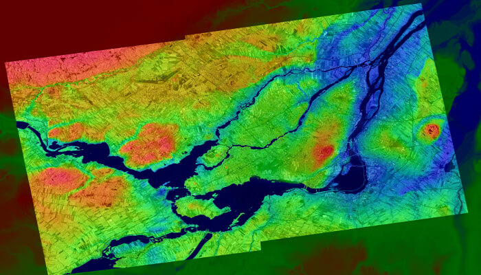
Lidar Point Cloud of Montreal
© CSA
Structure and Membership
The CCOG table is comprised of federal, provincial, and territorial members. These members are subject matter experts that contribute to the development of open and nationally representative geospatial base layers, ensuring that they represent the unique characteristics of each province and territory while adhering to widely recognized standards.
CCOG has four permanent working groups (WGs) that play a crucial role in advancing CCOG priorities and work planning: GeoBase Steering Committee (GeoBase SC); Cadastral Working Group; Canadian Geodetic Reference System Committee (CGRSC); and Governance WG.
With the expansion of CCOG’s objectives and priorities, five additional groups and task teams have been created: NG 911; Technologies; Geospatial for Disaster Risk Reduction, Response, Recovery – R4; Geo.ca; and Standards.
We support government decision making and service delivery
The council supports government decision making, and service delivery to citizens in many areas, including:
- Sustainable development and environment
- Land-use planning and natural resources integrated management
- Public safety and security
- Public health and education assessment and surveillance
- Physical and critical infrastructure planning
- Water-use and management
- Social service planning and delivery
We promote cooperation and the exchange of geomatics data
The council promotes cooperation and the exchange of geomatics data to reduce duplication of effort and to facilitate easy access to and use of geographical information by all Canadians. This is done through the promotion of standards and the development of Canada’s geospatial data infrastructure.
The council develops, promotes and spreads national and international geomatics standards. Standards are necessary to facilitate open sharing of spatial data between platforms, especially in a varied network of computers that are managing a diverse range of spatial data stores and data types.
The council works to support Canada’s geospatial data infrastructure (CGDI), a web-based knowledge infrastructure that improves the efficient access, sharing and use of geospatial data. The CGDI consists of:
-
- Operational policies covering areas such as intellectual property, data sharing and privacy, governing the use and re-use of the geospatial data
- Technology tools to enable the search, discovery, viewing, downloading and transformation of geospatial data
- Standards for the geospatial data and for the technology tools to ensure that all elements function seamlessly and efficiently with each other
- Geospatial data itself